Yellowstone National Park urges travelers to stay informed about road status and weather that can change quickly with heavy snow and hazardous driving conditions.
State preparedness activities have included filling sandbags, shoring up dikes, and the updating of some county websites with additional information and resources.
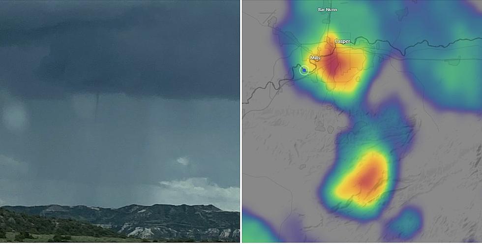
The storm could produce gusty winds -- there's a 2% chance of tornadoes in the Casper-area. Severe hail will be the size of a quarter or bigger in Central Wyoming.